| |
|
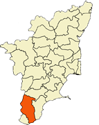
Tamilnadu - Tamilnadu Districts - Tirunelveli District
Tirunelveli District
Tirunelveli District திருநெல்வேலி மாவட்டம் is a district of Tamil Nadu state in southern India. The city of Tirunelveli is the district headquarters. A unique feature of this district is that it consists of all five geographical traditions of Tamil Literature; Kurinji , Mullai (forest), Marudham , Neithal and Palai . Tirunelveli District was formed on September 1, 1790 by the East India Company(British Government which comprises of present Tirunelveli and Tuticorin district and parts of Virudhunagar and Ramanathapuram district. It is the second largest district as on October 2008 after Villupuram district. |
 |
History
Nellaippar Temple
Tirunelveli District was formed on September 1, 1790 (Tirunelveli Day) by the East India Company (British) and named it as Tinnevelly district though their headquarters was first located in Palayamkottai the adjacent city, where they had their military headquarters during their operations against the Palayakars. There are three reasons attributed for naming the district after Tirunelveli. The prime one is that it has been serving as the main city of the district and the second one is that it has been called called as Tirunelveli Seemai under the Nayaks and Nawabs. Finally it served as the south capital in the period of Pandyan Kingdom. Both Tirunelveli and Palayamkottai grew as the twin cities of the district.
In early 1900's, parts of Tirunelveli district was made as Ramanathapuram and Virudhunagar districts. In 1986, Tirunelveli district was further split into two districts for administrative purpose such as Chidambaranar (present-day Thoothukudi and Nellai-Kattabomman (later Tirunelveli-Kattabomman, present-day Tirunelveli districts.
| Country |
 India India |
| State |
Tamil Nadu |
| District(s) |
Tirunelveli |
| Subdistrict |
Tirunelveli, Palayamkottai, Sankarankovil, Ambasamudram, Nanguneri,kadayanallur Radhapuram, Tenkasi, Shenkottai, Alangulam, Veerakeralampudur, Sivagiri |
| District formed on |
September 01, 1790 |
| Headquarters |
Tirunelveli |
| Largest city |
Tirunelveli |
Basic Infrastructure
The district is crisscrossed by a network of Roadways and Railways. Tirunelveli city is the main transit hub of the district. At present the district is not served by Air transport, for which people have to utilize the nearby airports of Thiruvananthapuram, Madurai and Tuticorin. The district ha a total of 27 Railway stations. Given below are tables listing the length of roads and railways in the district.
| Roads |
National Highways |
State Highways |
Corporation and Municipalities Road |
Panchayat Union and Panchayat Road |
Town Panchayat and Townships Road |
Others (Forest Roads) |
| Length (km.) |
174.824 |
442.839 |
1,001.54 |
1,254.10 & 1,658.35 |
840.399 |
114.450 |
| Railway |
Route Length (km.) |
Track Length (km.) |
| Broad Gauge |
77.000 |
95.448 |
| Meter Gauge |
125.000 |
134.430 |
|
|
|
|