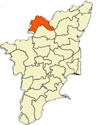
Tamilnadu - Tamilnadu Districts - Krishnagiri - Krishnagiri District

Krishnagiri District

The Krishnagiri District கிருஷ்ணகிரி மாவட்டம் i district in the state of Tamil Nadu, India. The city of Krishnagiri is the district headquarters.

Krishnagiri District has a prehistoric importance. Archaeological sources confirm the presence of habitats of man kind during Paleolithic, Neolithic and Mesolithic Ages. Various rock paintings and rock carvings of Indus Valley civilization and Iron Age seen in this district support the historical significance of this district. The heart of Krishnagiri,Kaveripattinam,Hosur and Uthangarai were known as 'Eyil Nadu', 'Murasu Nadu' and 'Kowoor Nadu' respectively.

Krishnagiri district

During the Chola period, Krishnagiri region was called 'Nigarili Chola Mandlam' and 'Vidhugadhazhagi Nallur'. Under the Nulamba rule it was popular as 'Nulambadi' according to historical sources. Hero stones were erected for those whose lost their lives in pursuit of adventure. There was a tradition of erecting memorial stones for people who sacrifice their lives for the sake of their kings since Sangam age. These memorial stones were called 'Navagandam'. Plenty of memorial stones available in this district speak volumes about the valour and virtues of the people.

Krishnagiri district covers an area of 5143 km². Krishnagiri district is bound by Vellore and Thiruvannamalai districts to the East, State of Karnataka to the west, State of Andhra Pradesh to the North and Dharmapuri District to the south. This district is elevated from 300m to 1400m above the mean sea level. It is located between 11º 12'N to 12º 49'N Latitude, 77º 27'E to 78º 38'E Longitude.


Taluk H.Q

Latitude (N)

Longitude (E)

Krishnagiri Taluk 12o 32’ 44” 78o 13’ 36”
Pochampalli Taluk 12o 20’ 78o 22’
Uthangarai Taluk 12o 15’ 78o 33’
Hosur Taluk 12o 48’ 77o 50’ 23”


Year

Rain fall (in mm)

2001-2002 825.700
2002-2003 521.600
2003-2004 1075.600
2004-2005 230.620
2005-2006 1262.800

Net Cultivated, Irrigated, Double , Multiple Cropped, Cultivable Wasteland, Water land and Forest

Classification

Geo.

Extent (Ha)

Forest 202409 39%
Banner and uncultivable waste 24194 5%
Land put to non agricultural uses 21466 4%
Cultivable waste 6341 1%
Permanent pastures and other grassing lands 7378 1%


Revenue Divisions

3

Taluks

8

Blocks

13

Corporation & Municipalities

10

Town Panchayats

24

Revenue Villages

1137

Panchayat Villages

648